The book I am writing

The Meridian
Project

A book about how to live a 368-day year

To try to live the longest year in the world, I started 2024 in Kiribati, in the middle of the Pacific, and ended it in American Samoa, on the other side of the International Date Line.

That is how I ended up travelling twice to the Pacific and asking why the Date Line zigzags, who chose the meridians and time zones, and where exactly each new day begins. Along the way I found the scientists and explorers who tried to answer those questions. That is what this book is about.

Starting point
Tarawa, Kiribati
Destination
Pago Pago, American Samoa
Travel notebook · 01 1.3278° N, 172.9769° E
Aerial view of a Kiribati atoll surrounded by the ocean
Fig. 1. Kiribati from the air, at the start of the first journey. Photo: Evaristo Babé

The first question

Can you live a 368-day year?

It began in November 2023, during a video call with my cousin María de la O. Half joking, she suggested that I find a way to make the year longer. As soon as we hung up, I wanted to know whether it could be done.

I asked ChatGPT where I should begin and end 2024 to make it last as long as possible. It told me to welcome the year in Kiribati and see it out in American Samoa.

Within forty-eight hours I was looking for flights and accommodation. Building the route meant understanding the International Date Line. I kept reading and eventually began writing The Meridian Project.

  1. 01
    Be among the first to enter 2024

    I arrived in Tarawa on 29 December 2023 and welcomed the new year in Betio. I then travelled through Fiji and Vanuatu.

  2. 02
    Be among the last to leave 2024

    A year later I returned to the Pacific. The final leg ran from Samoa to American Samoa: a twenty-minute flight and a twenty-four-hour time difference.

Time travel

How to celebrate New Year’s Eve twice in 24 hours

I took off in 2025. Twenty minutes later, I landed in 2024.

I welcomed 2025 in Samoa. Twelve hours later I took off from Apia and, after a twenty-minute flight, landed in Pago Pago. I had crossed the International Date Line and it was still 12:20 p.m. on 31 December 2024. That evening I celebrated New Year’s Eve for the second time.

That jump brought the total to 368 days. The leap year already gave 2024 366 days. I began it in Kiribati, one of the first inhabited places to enter the year, and ended it in American Samoa, one of the last to leave it.

Departure · Apia 1 January 2025 · 12:00
20-minute flight
24 hours back
Arrival · Pago Pago 31 December 2024 · 12:20

The journey to finish 2024 · Pacific

The route across the Pacific

To finish 2024, I returned to the Pacific. This route was longer: New Zealand, Tonga, Fiji, Samoa, American Samoa and Hawaii. Three questions kept following me throughout the journey:

  • Why is the International Date Line where it is?
  • Why does it zigzag instead of running straight?
  • Why does crossing it change the date?

When I came home, I began looking for the answers.

Stories behind the book

Elcano, the Scilly Isles, Harrison and the railways

A lost day, four ships against the rocks, a clock that could determine longitude and a railway network that could no longer run with a different time in every town.

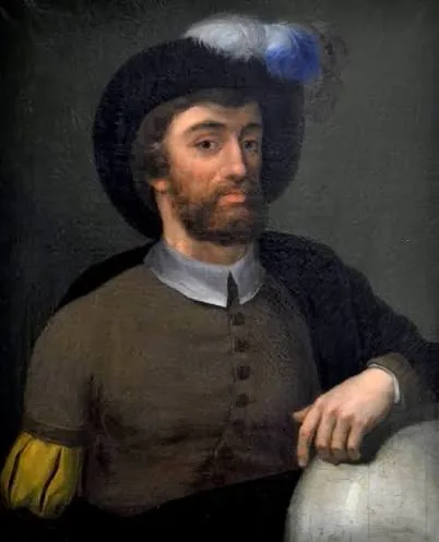
Historical portrait of Juan Sebastián Elcano
File 01 · First circumnavigation
1522

The missing day

When the survivors of Magellan and Elcano’s expedition returned in 1522, they discovered that their calendar was one day behind. They had counted correctly and still one day was missing.

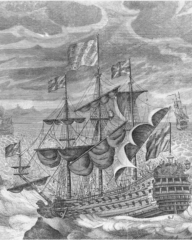
Engraving of HMS Association during the 1707 Scilly naval disaster
File 02 · The Scilly naval disaster
1707

Four ships against the rocks

After days without a clear view of the sky, Admiral Shovell’s fleet miscalculated its position at sea. Four ships struck the rocks off the Isles of Scilly and more than 1,300 men died. The disaster became inseparable from the problem of knowing where a ship was.

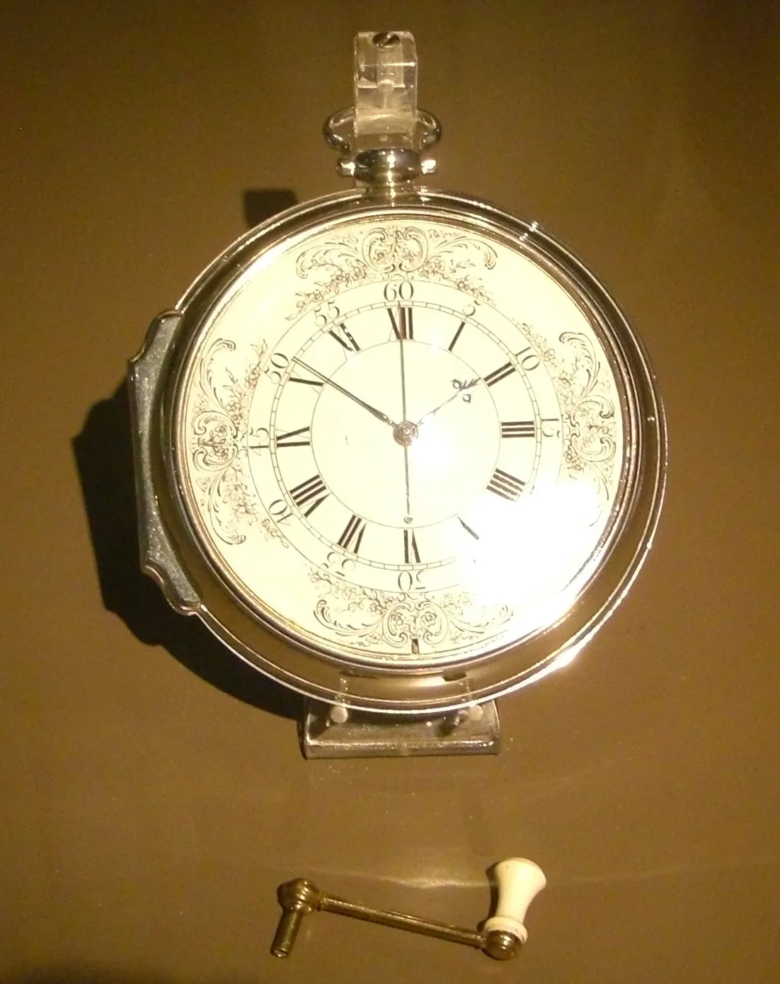
John Harrison’s H4 marine chronometer on display in Greenwich
File 03 · The longitude problem
1759

A clock that could tell you where you were

John Harrison was a carpenter who spent much of his life building a clock that would keep time at sea. His H4 made it possible to calculate longitude far more accurately.

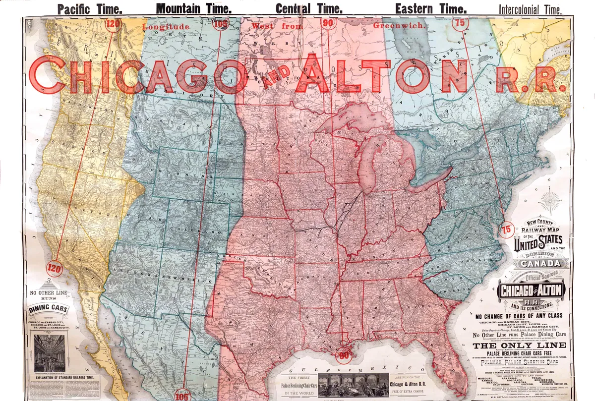
Map of the Chicago and Alton Railroad time zones in 1883 and 1884
File 04 · Railway time
1853–1883

Time could cause accidents too

Railways depended on clocks to keep trains from meeting on the same track. In 1853, a conductor’s inaccurate watch contributed to a fatal collision. The United States eventually had around fifty different railway times; the confusion led to standard time in 1883.

A few stories from the book

Did you know…?

01

Mexico and the Philippines shared the same date for centuries.

In the Philippines, 31 December 1844 never happened.

02

Ptolemy placed zero at the western edge of the world he knew.

Before Greenwich, the prime meridian ran through El Hierro.

03

The metre was born from measuring the planet.

The French measured from the equator to the North Pole along the Paris meridian. They divided that distance into ten million parts: each would be one metre.

04

Eleven dates vanished from the British calendar.

In 1752, people in Britain went to bed on 2 September and woke up on the 14th.

Curious stories from the book

Lost days, secret lines and other oddities

Questions about where we are, what time it is and what day we are living in turn up in novels, films, conspiracies and prophecies. The book uses them to explain why meridians exist, who decided where to put them and what happens when they are crossed.

The strangest attempts to put the world in order

Pyramids, dogs and calendars

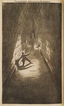
1714 engraving of the interior of the Great Pyramid of Giza
Nineteenth century

The Cheops meridian

Charles Piazzi Smyth measured the Great Pyramid and argued that it concealed a universal system of measurement and occupied a privileged place on Earth. Science rejected his theories; pyramidology survived.

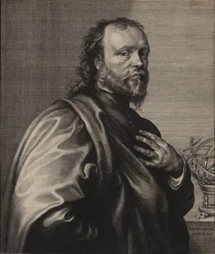
Engraving of Sir Kenelm Digby beside an armillary sphere
Kenelm Digby · seventeenth century

A dog used as a clock

In 1688, a satirical pamphlet proposed taking a wounded dog aboard ship and dipping its bandage into ‘powder of sympathy’ in London every noon. The dog’s howl would signal the time from thousands of miles away.

Portrait of Pope Gregory XIII
Rome · 1582

Ten days that disappeared

To correct the drift in the Julian calendar, Gregory XIII ordered that Thursday 4 October 1582 be followed by Friday the 15th.

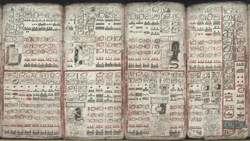
Pages of the Dresden Codex with Maya tables and calculations
21 December 2012

The end of the world that never came

The end of a cycle in the Maya Long Count became a global prophecy: the world would end on 21 December 2012. There were films, shelters and apocalyptic tourism. The day arrived. And life went on.

Evaristo Babé in Tarawa, Kiribati
Tarawa, Kiribati. Photo: Evaristo Babé 1.3278° N, 172.9769° E

The author

I’m Evaristo Babé.

In 2024 I travelled twice to the Pacific to try to live the longest year possible. Afterwards, I searched books and archives to understand how we came to decide where we are, what time it is and when each day begins. I am now writing that story.

Welcome to Pago Pago sign in front of a forested mountain
08 Pago Pago, American Samoa · arrival 14.2756° S, 170.7020° W

The end of the journey

Pago Pago

I took off from Apia at noon on 1 January 2025. Twenty minutes later I landed in Pago Pago, where it was 12:20 p.m. on 31 December 2024. The journey had ended on the previous day.

End of the journey Pago Pago
Image credits and sources

Travel photographs: Evaristo Babé Ayuso.

Juan Sebastián Elcano: portrait held by the Naval Museum in Madrid. Image by Nahia Blanco Iturbe, Wikimedia Commons, CC BY-SA 4.0.

Scilly naval disaster: anonymous engraving from around 1710, held by the National Maritime Museum in Greenwich. Image from Wikimedia Commons, public domain.

John Harrison’s H4: photograph by Colonel Warden, Wikimedia Commons, CC BY-SA 3.0.

Chicago & Alton Railroad: map of the new time zones, 1883–1884. Image consulted at Chicagology.

International Date Line: diagram made for this page using information from the U.S. Naval Observatory.

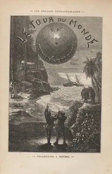
Around the World in Eighty Days: illustrated title page by Léon Benett, around 1874, held by Houghton Library. Image from Wikimedia Commons, public domain. Phileas Fogg’s gained day can be read in chapter 37.

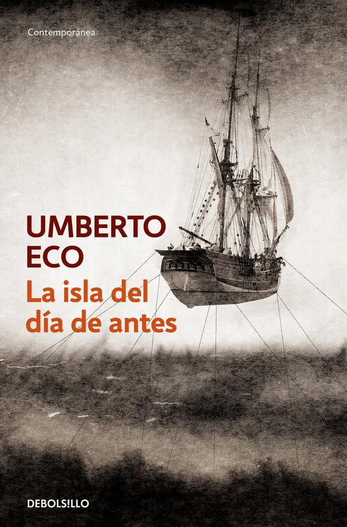
The Island of the Day Before: cover of the edition used on this page.

The Nautical Chart: cover of the Debolsillo edition. Plot and latitude and longitude details consulted in the Arturo Pérez-Reverte catalogue.

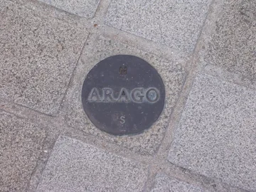
Paris meridian: photograph of an Arago medallion by Poulpy, Wikimedia Commons, CC BY-SA 3.0. The route of the 135 medallions is documented by the Paris Observatory.

Great Pyramid: engraving by Cornelis de Bruijn, 1714, Wikimedia Commons, public domain. Piazzi Smyth’s research and theories are summarised by National Museums Scotland.

Kenelm Digby: engraving by Robert van Voerst after Van Dyck, Wikimedia Commons, public domain. The story of the powder of sympathy and its proposed use to solve the longitude problem is documented by the Royal Society.

Gregory XIII: anonymous sixteenth-century portrait, Wikimedia Commons, public domain.

Dresden Codex: pages 55–59 and 74, Wikimedia Commons, public domain. The explanation of the 2012 cycle change comes from NASA’s NASA Jet Propulsion Laboratory.

‘Did you know?’ sources: the Philippines date change is documented by Utrecht University; the missing day from the first circumnavigation by the Institute of Naval History and Culture; the El Hierro and Ptolemy meridians by the Isaac Newton Group of Telescopes; the origin of the metre by the BIPM; the British calendar change by Royal Museums Greenwich; railway time by the Smithsonian; and the powder of sympathy proposal by the Royal Society.