MAPS AND HISTORY
Morrell and Byers: phantom islands on the Date Line
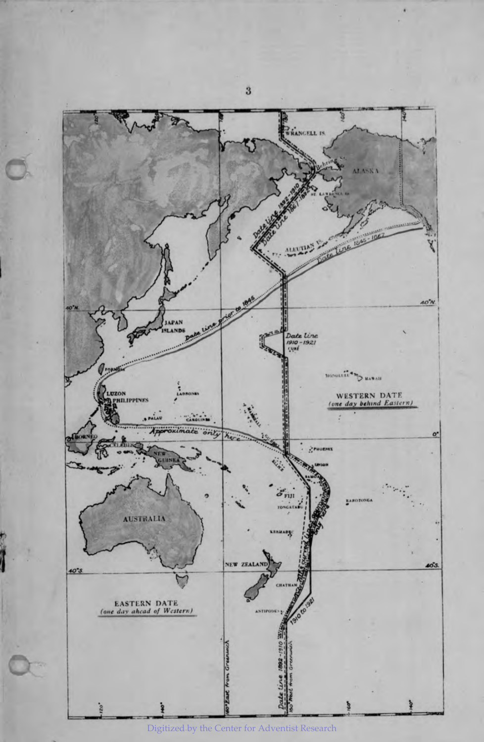
A bend beside two islands
Maps change not only when governments alter calendars, but also when cartographers revise what they know about the ocean. Morrell and Byers show the difference.
What we know about 1910
A British Hydrographic Department account published in 1930 says that a bend near Morrell and Byers was removed in 1910. Its map compares routes from different periods. It shows that the drawing changed, but does not show a population skipping or repeating a day.
Why draw the bend?
Historian R. H. van Gent explains that the bend kept the supposed islands on Hawaii’s date, and that their non-existence was established by 1910. That explanation remains attributed to Van Gent: the exact 1899/1900 and 1910 charts still need to be checked.
A historical map and a reconstruction are different
The 1930 plate is a retrospective historical document. Modern diagrams reconstructing 1900, 1910 and 1921 help comparison but are not the original charts from those years. The explorer separates these variants from civil calendar changes.
Sources and scope
You can consult the sources here. Where a detail still needs checking, we say so in the text.